Flotilla 7-5 What's New!
Lake Travis Crew Training
Fri, 05 Oct 12 Posted by: Si Dunn
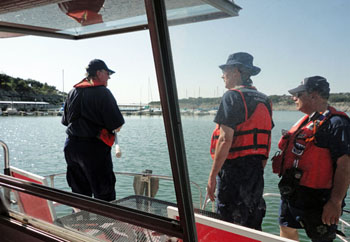
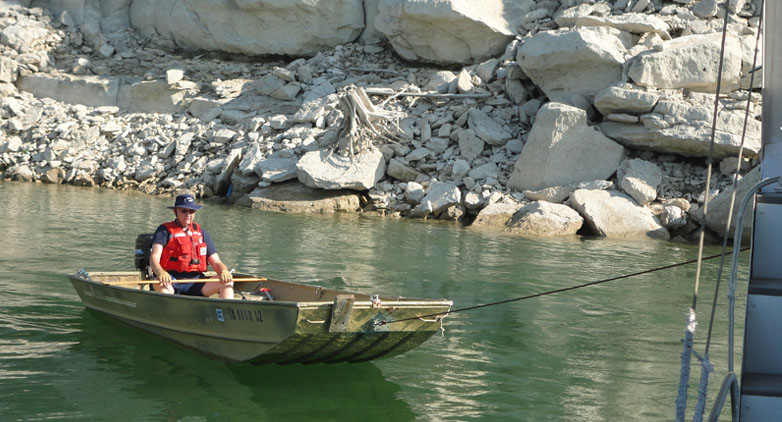
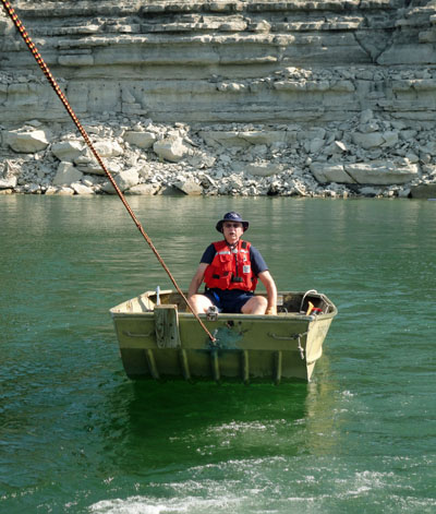
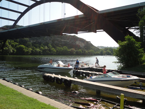
VFC Larry VanGoethem plays the part of a stranded boater as he
awaits a stern tow from AUXFAC Alstarr II on Lake Travis.
"Whoa! Slow down!" VFC Larry VanGoethem seems to be saying
as Alstarr II begins the stern-tow training exercise.
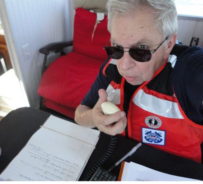
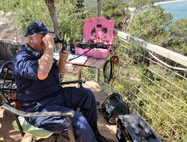
FSO-PA and TCO Si Dunn transmits an "Ops Normal" position report
to "Austin Radio" while "Auxiliary One-Niner-Two"operates
near Arkansas Bend on Lake Travis.
Sea Scout Mentoring
Mon, 10 Sep 12
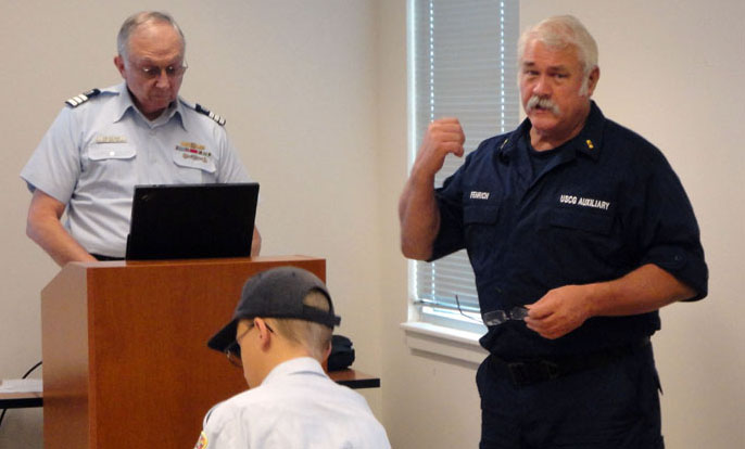
Flotilla 75 members recently provided mentoring to local Sea Scouts in areas that included marlinspike seamanship and radio communications.
Below, FSO-IS Larry Van Goethem and FSO-CM Paul Fenrich deliver a presentation on VHF and HF radio procedures that Sea Scouts must be prepared to use.
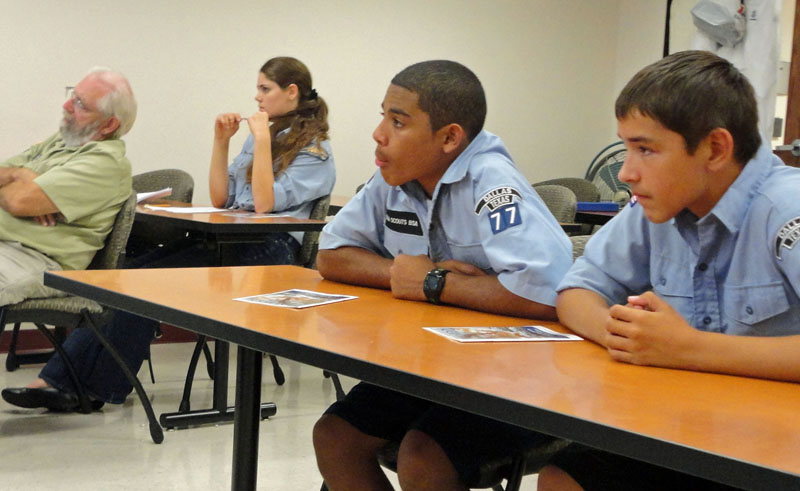
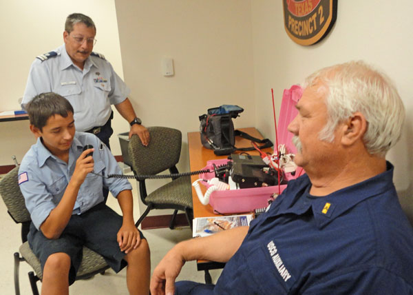
Above, Sea Scouts listen to the presentation, and a Sea Scout later tests his radio operating skills under the watchful eyes of FC Alan Mark (standing) and FSO-CM Paul Fenrich.
Honoring 60+ Years as a Coast Guard Auxiliary Volunteer
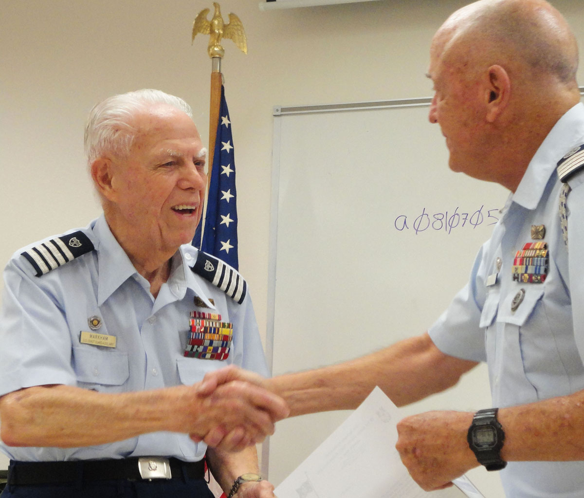
During a ceremony honoring his 60 years of service as a Coast Guard Auxiliary volunteer, Flotilla 75's J. Earl Markham (left) receives congratulations and a certificate from District 8 DCOS Michael Vandermate at the July 2012 flotilla meeting.
Demand for the Coast Guard publication, A Boater's Guide to the Federal Requirements for Recreational Boats, has been very heavy this spring and the supply in the Auxiliary National Supply Center (ANSC) has been exhausted. This publication, ANSC#3006, contains information about federal boating laws, equipment requirements, and safety recommendations for recreational vessels. Loaded with charts, graphics, and diagrams, this brochure covers navigational rules, cold water survival, life jacket requirements and America's Waterway Watch information. It is particularly useful in support of public education, vessel examinations, program visitation, and public affairs missions.
A new supply is anticipated at ANSC in mid-July. In the meantime you are urged to check within your flotilla or division to see if there are supplies of this publication that can be re-distributed.
Available online at the Coast Guard Boating Safety Division website.
Telecommunications Operator (TCO) Mentoring
LAKES WE SERVE
-
Lady Bird Lake
-
Lake Austin
-
Lake Travis
-
Lake Marble Falls
-
Lake LBJ
-
Inks Lake
-
Lake Buchanan
-
Lake Georgetown
-
Granger Lake
-
Walter E. Long Lake (also known as Decker Lake)
-
Lake Bastrop
Seven of the eleven lakes are part of the Highland Lakes reservoir system on the Colorado River. The seven reservoirs are Lady Bird Lake, Lake Austin, Lake Buchanan, Inks Lake, Lake LBJ, Lake Marble Falls, and Lake Travis. Here is some basic information about each lake in Flotilla 75’s area of coverage.
LADY BIRD LAKE
Still called “Town Lake” by many Austin residents, Lady Bird Lake is a Colorado River reservoir located in downtown Austin, Texas. The lake was created in 1960 by construction of Longhorn Dam on its eastern end. Its western boundary was established in 1939 by construction of Tom Miller Dam. The Town Lake reservoir was renamed “Lady Bird Lake” in 2007. It is owned and operated jointly by the City of Austin and the Lower Colorado River Authority (LCRA). The lake’s surface area is about 468 acres, and the water is used primarily for flood control and recreation. The lake is approximately six miles long (although some descriptions list it as nine miles long), and its maximum water depth is approximately 18 feet. The surface elevation is 428 feet above sea level. The City of Austin prohibits operation of most motorized watercraft on Lady Bird Lake. As a result, the lake serves as a popular recreational area for kayaks, canoes, dragon boats, and rowing shells. Austin's warm climate and the lake’s calm waters make the lake especially popular with rowing crews, including some from northern universities who train here with their racing shells during the winter. Various types of regattas also have been held on the lake.
LAKE AUSTIN
Lake Austin is a reservoir used for flood control, electrical power generation, and recreation. According to the Texas Parks and Wildlife Department, the lake has a surface area of 1,599 acres. It is a “constant level” lake with a maximum depth of 75 feet. The depth can fluctuate slightly with water releases from Lake Travis upstream. The LCRA is the reservoir’s controlling authority. Lake Austin has been stocked with several species of fish intended to improve the utility of the reservoir for recreational fishing. Fish present include largemouth bass, sunfish and catfish. The lake is one of several Highland Lakes that is invested with hydrilla, a non-native aquatic plant species.
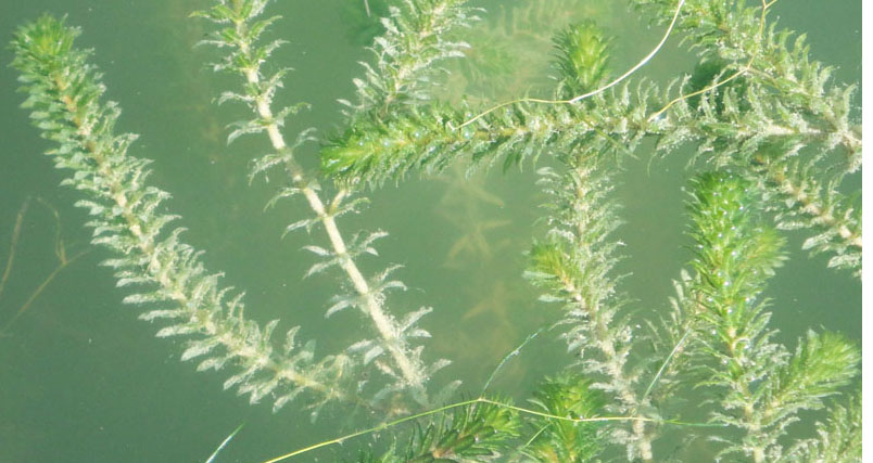
The Lower Colorado River Authority sometimes has lowered water levels in Lake Austin in the months of January and February so freezing air temperatures can help destroy some of the hydrilla. Some 3,000 hydrilla-eating sterile grass carp recently were added to Lake Austin at a price of more than $6 per fish. Almost all the shoreline around Lake Austin is privately owned.
Bank access can be found at the Capital of Texas Highway (Loop 360) bridge, at Emma Long Park, Mary Quinlan Park, and Fritz Hughes Park near Mansfield Dam. Two concrete public boat ramps are available: the Walsh Boat Landing, located off Lake Austin Blvd., and a ramp below the Loop 360 bridge. That ramp's location is near 30°21'N 097°48'W. Additional ramps are located at Emma Long Park and Mary Quinlan Park. (City of Austin Parks and Recreation Department, 512-974-6700).
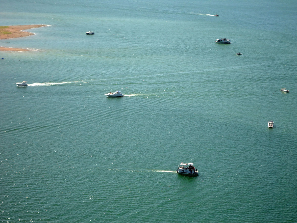
LAKE TRAVIS
Lake Travis is the longest of the seven Highland Lakes reservoirs. It stretches 65 miles upriver from western Travis County, following a snaking course that takes it into southern Burnet County, to the Max Starcke Dam, which is southwest of the town of Marble Falls. Lake Travis is used for flood control, water supply, hydroelectric power generation, and recreation. The lake is the main flood control reservoir in the Highland Lake chain. The lake’s water level can vary considerably, depending drought conditions and the amount of rainfall in the Colorado River basin upstream. The lake has a surface area of 18,930 acres and a maximum depth of 210 feet. It has 270 miles of shoreline. Lake Travis is considered "full" when the water level is at 681 feet above mean sea level). Above 681 feet, the flood control gates are opened under the direction of the U.S. Army Corps of Engineers.
The lake is popular for fishing, boating, swimming, scuba diving, picnicking and camping. It is generally considered one of the state’s clearest lakes, and it serves as a vital water supply for Austin and the surrounding metropolitan area. One of the Colorado River’s major tributaries, the Pedernales River, flows into Lake Travis from the southwest in western Travis County. The public boat ramp at Mansfield Dam Park is located at 30°23'44"N 097°54'14"W. A public pier for boarding or disembarking from boats is located a short distance to the south of the Mansfield Dam Park boat ramp.
LAKE MARBLE FALLS
Lake Marble Falls, located near the town of Marble Falls, is the second-smallest lake in the Highland Lakes reservoir system. (Lady Bird Lake is the smallest.) Lake Marble Falls has a surface area of 611 acres. It is used for recreation and hydroelectric power generation. The lake also is home to the annual Lake Marble Falls Lakefest drag boat races. The lake is 5.75 miles long and 1,080 feet wide in the widest area. Maximum water depth is 60 feet. Surface elevation is 738 feet. Most of the shoreline bordering the lake is privately owned. Unlike most other reservoirs in the Highland Lakes system, Lake Marble Falls does not have a hydrilla problem. Fish in the lakes include bass, sunfish and catfish.
LAKE LBJ
Lake Lyndon Baines Johnson (Lake LBJ) is located 45 miles northwest of Austin. It is one of the Highland Lakes reservoirs and is used for recreation, as well as a source of cooling water for the Thomas J. Ferguson power plant, a natural-gas-fired facility operated by the LCRA. The lake has a surface area of 6,534 acres. Its maximum depth is 90 feet, and the surface elevation is 825 feet. The lake gets inflows from the Colorado River and the Llano River. Lake LBJ is a constant-level lake that is popular for boating, water-skiing, jet-skiing, fishing and other water sports. Like several other reservoirs, Lake LBJ has a problem with hydrilla. The towns of Granite Shoals, Kingsland, Horseshoe Bay, Highland Haven, and Sunrise Beach are located next to the lake. Most of the land bordering Lake LBJ is privately owned. President Lyndon Johnson owned a separate ranch bordering the lake and often entertained visiting foreign dignitaries on the water during his Administration.
INKS LAKE
Inks Lake is a small flood-control and hydroelectric reservoir in the Highland Lakes system. It is located at the border of Burnet and Llano counties. It is used in tandem with Lake Buchanan to help provide flood control. It has a surface area of 831 acres. Its maximum depth is 60 feet, and the surface elevation is 888 feet. Inks is normally a constant-level lake, with a variation in depth of about one foot. But the level can rise more as flood waters from upstram are passed through Inkls Lake to the lakes downstream. The lake is popular for boating and fishing. Some swimmers also engage in cliff jumping into the water.
LAKE BUCHANAN
Lake Buchanan is the oldest and largest of the Highland Lakes reservoirs. It has a surface area of 22,333 acres (34.9 square miles), and a maximum depth of 132 feet. Its surface elevation is 1,020 feet. The lake is west of Burnet, Texas, in Burnet and Llano counties. The LCRA formed Lake Buchanan in 1939 by building Buchanan Dam, which is more than two miles long. The lake was created to provide water supply and hydroelectric power for the region. It is popular for recreational boating and fishing. The predominant species of fish are catfish and several varieties of bass. Lake Buchanan is a level-controlled reservoir and is not allowed to flood during periods of heavy rain. However, the water level can drop significantly during periods of drought. Much of the property bordering the lake is privately owned, and many lakeside cottages and homes are rented out on a regular basis. The LCRA maintains three parks on the lake: Cedar Point Recreation Area, Black Rock Park, and Canyon of the Eagles. County parks and private marinas provide boating access to the lake.
LAKE GEORGETOWN
Lake Georgetown is a U.S. Army Corps of Engineers flood control reservoir. It is located on the San Gabriel River, three miles west of Georgetown in Williamson County, north of Austin. The surface area is 1,297 acres. The maximum water depth is 85 feet. And the surface elevation is 791 feet. The North San Gabriel Dam, Lake Georgetown, and all adjacent property are managed by the Fort Worth District of the U.S. Army Corps of Engineers. The dam was completed in 1979. The lake also is a drinking water source for Georgetown and Round Rock, and it is a popular spot for recreational boating and fishing. The fish in the lake include catfish, crappie, sunfish and several varieties of bass. Cedar Break Park and Jim Hogg Park have recreational boat ramp facilities. The 16-mile-long Good Water Trail is a hiking trail that follows the entire southern side and much of the northern side of the lake.
GRANGER LAKE
Granger Lake, located on the San Gabriel River in Williamson County, is a U.S. Army Corps of Engineers flood-control reservoir. Its surface area is 4,064 acres, and the maximum water depth is 50 feet. The surface elevation is 504 feet. The lake is near the towns of Granger and Taylor. It is about 10 miles northeast of Taylor and 35 miles from Austin. Granger Lake is located in a relatively flat agricultural area that is prone to high winds. It is primarily a facility for fishing. The major fish species include catfish, white bass, and crappie. Along with maintaining the dam that creates the reservoir, the Corps of Engineers maintains recreational facilities at the lake. Taylor Park, Willis Creek Park, and Wilson H. Fox Park have boat ramps for lake access.
WALTER E. LONG LAKE / DECKER LAKE
Walter E. Long Lake is widely known as Decker Lake. Located in Travis County, just east of Austin, the lake’s surface area is 1,269 acres, and its maximum depth is 60 feet. The surface elevation is 555 feet, and Walter E. Long Lake (or Decker Lake) is a near-constant-level reservoir. The City of Austin is the reservoir’s controlling authority, and the lake is used for power-plant cooling.

Public activities include boating, jet skis, and swimming. The lake also is popular for recreational fishing, primarily for sunfish, catfish, crappie and bass varieties. Because the city owns the land surrounding the lake, there are no private boat docks or houses along the water's edge, but there are distinct creek channels, drop-offs, and submerged tank dams in parts of the reservoir. The water remains warm during the winter if the power plant is generating, and part of the discharge canal is open to fishing from a boat. The lake has some problems with several plant species, including hydrilla and bulrush. Public access includes a concrete boat ramp at Walter E. Long Metropolitan Park, near the intersection of FM973 and Decker Lake Road. The boat ramp is located at 6799 Blue Bluff Rd., Austin, TX 78724, near 30°17′N 97°36′W.
LAKE BASTROP
30°9.31’N 097°17.51”W
Lake Bastrop is located in central Bastrop County, about three miles northeast of the city of Bastrop. Lake Bastrop is a constant-level power plant cooling reservoir that also is used for recreational boating, fishing and swimming. The lake provides cooling water for two power plants: the Sim Gideon Power Plant operated by the Lower Colorado River Authority (LCRA) and the Lost Pines Power Project 1, owned by GenTex Power Corp., a wholly owned affiliate of the LCRA. The lake’s surface area is 906 acres, and the lake has a maximum depth of 60 feet. The primary inflow and outflow for Lake Bastrop is Spicer Creek. The LCRA built a dam in 1964 to form the reservoir. The LCRA operates two public parks on Lake Bastrop: South Shore Park and North Shore Park.
The North Shore Park boat ramp is located at FM1441. Bastrop, TX 78602, near 30°10'N 97°17'W.
Facilities for camping and picnicking are available. Approximately one quarter of the shoreline of Lake Bastrop is privately owned by the Capitol Area Council, Boy Scouts of America. and used for the Lost Pines Scout Reservation, consisting of Camp Tom Wooten, for Cub Scouts and Camp Lost Pines, for Boy Scouts. Lake Bastrop is a popular fishing lake, and the species include catfish, crappie, perch, sunfish, carp, and large-mouth bass.