Our Waterways
Navigating Our Waters
National Weather Service Forecast Office Newport/Morehead City
National Weather Service Marine Forecast FZUS52 KMHX
Marine Forecasts for both Coastal and Offshore
MARINERS ARE ADVISED TO USE CAUTION WHILE TRANSITING THROUGH THE STATE OF NORTH CAROLINA. RIGHT WHALES ARE EXPECTED TO BE ENCOUNTERED OFFSHORE THE STATE OF NORTH CAROLINA AND MARINERS ARE ADVISED TO KEEP A 500 YARD DISTANCE FROM NORTH ATLANTIC RIGHT WHALE. ALL VESSELS SHALL INCORPORATE THE APPROACH GUIDANCE OF 500 YARDS.
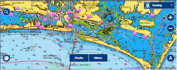
Reading a Chart: Symbols, Abbreviations and Terms used on Paper and Electronic Navigational Charts
 Tides & Currents North Carolina
Tide and Current Table at Duke Marine Lab in Beaufort, NC
Local Notice to Mariners (scroll down to download this week's notices)
Coast Pilot: Cape Lookout to Cape Fear (Click NC on map; proceed to Chapter 5)
Flood Inundation Mapping and Alert Network in Real-Time
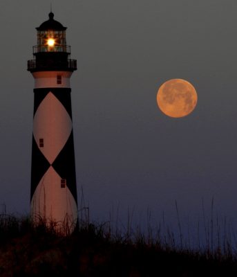
Full moon setting at Cape Lookout. Photo: Sam Bland
Your VHF radio, whether handheld or stationery, should have a DSC feature. Please see this short video on this very important topic which can save your life!