Return to Flotilla 5-10's Home Page.

Flotilla Phone Number: 917-979-3992
Directions:
The Coast Guard Battery Building is located on the right side (West) of the Staten Island Ferry Terminal, as you face it. A point of reference is the Coast Guard Memorial, on the island of Peter Minuit Plaza: the USCG Building Entrance Gate and Guard Shack are behind it, when facing it: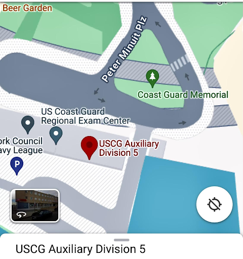

Enter the building on the left (East) side by the guard shack. Tell the guard that you are there for the Coast Guard Auxiliary meeting (2nd deck conference room). You may be required to present valid photo ID (driver’s license, etc.). Enter through the open side door. Our meeting is up one flight of stairs, through the break room.
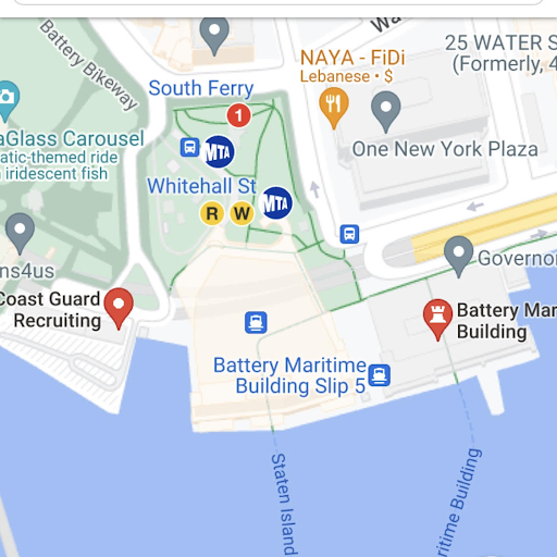
VAST choice of buses and subway:
The nearest subways are the D, B or W at Whitehall/South Ferry and A or 5 at Bowling Green, or GREAT free parking lot, past the guarded gate in the rear of the MIO building!
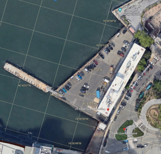
USCG Battery Building
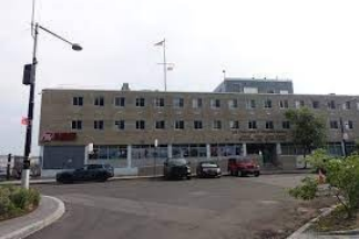
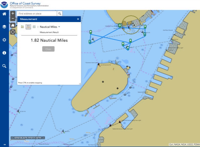
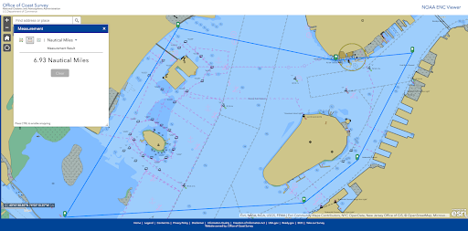
The USCG Battery Building serves as the operational location for our unit and it has a vessel launching ramp that is strategically located near the central point of the Governors Island Area Of Responsibility (AOR), approximately 0.5 nm away.
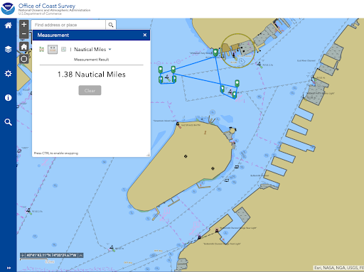
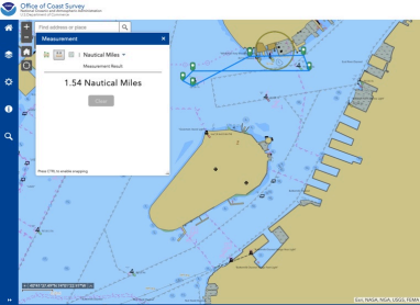
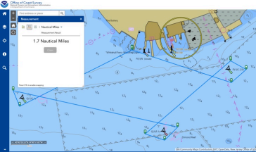
Aids to Navigation
The GI flotilla vicinity is supported by nearby Aids-To-Navigation (ATON) that are actively patrolled due to their critical role at one of the most busy ports and maritime waterways in the United States.

Public Education
Our flotilla regularly organizes Public Education courses with an emphasis on Boating Safety. During the boating season, from May to September, these classes are held on the second Thursday of each month at the Estuary Lab Classroom on Pier 84.
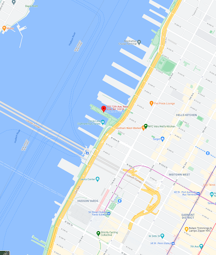
Estuary Lab Classroom, Pier 84 Boathouse
555 12th Avenue/Westside Highway, Manhattan, NY 10036
Take the M42 Bus from the Times Square/Port Authority Bus Terminal area
or
A good parking garage:
600 West 43rd Street
Manhattan, NY 10036