Navigation Systems
| USCG NavCen ► NOAA-NOS ► D1 NS Site ► National NS Information ► USCG D11(dpw) ► |
By regularly visiting our site you will have the resources and knowledge necessary to keep our waterways safe for the maritime public, our environment free from pollution and our charts and small craft facilities up to date. Sincerely, Michael David Hay, DSO-NSDistrict Eleven Northern Region The United States Coast Guard Auxiliary
|
D11NR Team
Michael David Hay DSO-NS James B. Duncan ADSO-NS-DP
|
| District 1 NR Navigation Systems shares with District 11NR many of their Navigation Systems Publications, Guides, Training information. You may be directed to D1NR Websites. |

What We Do
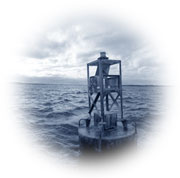
The U.S. Coast Guard has the responsibility for the establishment and maintenance of all Aids to Navigation on the Waterways of the U.S. This is an all-inclusive responsibility, and it includes the coastal waters and inland waters of the U.S. This responsibility is affected in conjunction with NOAA, National Ocean Service and other Federal Government agencies, State and Local Government elements and Private entities. The U.S. Coast Guard Auxiliary, in its overall supplemental supporting role, provides specifically authorized assistance to the Coast Guard in its Aids to navigation missions and National Ocean Service in its Chart Updating missions. This Auxiliary support effort is provided through the Aids to navigation and Chart Updating (ATON/CU) Program.
The Navigation Systems Division is a part of the Prevention Department. District 11NR (NS) & District 1NR share our Navigation Systems Publications, Guides, & other Training information. You may be directed to D1NR Websites for most of your information. D11 focuses geographically on Northern California, Nevada, and Utah waterways. Our mission is to ensure the safety of both commercial and recreational boaters supporting them in their navigation efforts through our five major roles.

Federal Aids to Navigation (ATON)
As a member of the USCG Auxiliary, we are tasked with looking for and reporting any and all discrepancies to Federal Aids to Navigation. Assisting ANT units and other Aids to Navigation request for assistance as needed. All members of the USCG Auxiliary should be on the watch for any aids to navigation discrepancies they see and report them.
Private Aids to Navigation (PATON)
As a Qualified & Certified Aid Verifier we are tasked with checking all Private Aids to Navigation assigned by District Eleven (dpw) on an annual basis. Always Looking for unauthorized and report all private aids that have been put in our federal waterway without a permit. Report any private aids to navigation that become or are hazards to navigation.Bridge Surveys (BAP)
As a Qualified & Certified Aid Verifier, we are tasked with surveying all assigned Bridge Lighting & Fender Systems by District Eleven (DPW) Bridge Section on an annual basis. We also assist D11(dpw) Bridge Section with information about waterways where new bridges may be planned. All members of the USCG Auxiliary should be on the watch for any bridge discrepancies they see and report them. Want More Information? If you are looking for more specific information contact any of your FSO-NS, SO-NS or DSO-NS officers and they will be happy to assist you.Chart Updating (CU)
As a member of USCG Auxiliary, our focus for the Auxiliary Navigation Systems Chart Updating (CU) Programs is on prevention, accuracy, credibility, and professionalism, and is directed toward raising your competence in the eyes of the NOAA. There are specific guidelines for taking fixes and depths that require pre-underway validation of all equipment that is used to perform measurements, and for reporting quality control evidence for each on-scene observation and instrument reading. Also required are explanations of the technique(s) used to acquire any reported data. Observers are directed to define each chart update task, list their on-scene observations, develop a conclusion from the collected evidence and make a final recommendation to NOAA-Office of Coast Survey. A fresh scientific approach is encouraged. Evidence can take the form of a fix taken with a GPS set using WAAS, depths corrected to the charted vertical datum, physical measurements, photographs, drawings, marked up chartlets, and printouts from the Internet. Any official document that supports your contention is great support evidence. The Internet can also supply great supporting data. In effect, you are pleading the case for acceptance of your premise as a chart update to NOAA-Office of Coast Survey.All Small Craft Facility Charts have been Cancelled
NOAA-Office of Coast Survey has canceled all small craft Facility charts. However, Office of Coast Survey will still accept as-built drawings for new marinas. Report function facilities that meet only the following five criteria will be charted:
- Open to the public
- Sell gasoline or diesel fuel
- Have a pump out facility
- Have transient berths or moorings
- Give an approach depth and an alongside depth
As a member of the USCG Auxiliary, we can still survey all public marinas, boat harbors, and other public marine facilities. We check for and report any and all discrepancies, correction, & additions to Navigational Charts & Coast Pilot. This work helps make sure that our Navigational Charts & Coast Pilot are accurate for the maritime public looking for the best location to get the needed supplies while on a boating or fishing cruise. Prepare all your Chart Update and/or Coast Pilot worksheet online will enhance the professionalism of your final Chart Updating reports to NOAA-Office of Coast Survey through the "Office of Coast Survey-How may we ASSIST you Today?" report system.

 Welcome Aboard . . .