Local Area Information
Welcome to Southwest Florida!
Local information you need to know before you go on the water.
Weather
-
Keep abreast of the weather. It can change quickly. It's always good to have a NOAA weather radio aboard your vessel. Many VHF radios have it as a standard feature.
-
If you're swimming near sand bars or beaches with high surf, you must be aware of rip currents. Rip currents can occur at any surf beach with breaking waves, including the Great Lakes. Rip currents do not pull people under water – they pull people away from shore.
-
Drowning deaths usually occur when people are unable to keep themselves afloat and swim back to shore. This may be due to fear, panic, exhaustion, a lack of swimming skills, or any combination of these factors.
-
Select the links below to check local weather conditions
| Weather.com | Weather Underground Radar |
Getting Help on the Water
- Help is available on the water. VHF Channel 16 is for
Hailing and Distress.
- Commercial Towing services such as TowBoatUS and
SeaTow are available through that channel.
- U.S. Coast Guard is
available for dire emergencies.
- Do not call the Coast Guard for radio
checks, out of gas, or engine failure unless it posses immediate danger
to yourself or others.
- Coast Guard Rescue 21 System supports DSC radio. Learn here to learn more about choosing and using a DSC Radio.
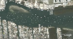
Speed Zones are Enforced
- You
must be aware of Speed Zones in the Caloosahatchee River in Lee County.
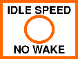
- Slow Speed means not on plane, settled in the water, not plowing, minimum wake.
- In the Caloosahatchee River, there is a 1/4 mile SLOW SPEED buffer along both sides of the river from downtown Fort Myers to Shell Island.
- Buoys are placed along this buffer to indicate the 1/4 mile distance.
- Between the Edison Bridge and the railroad trestle, the speed regulation is 25mph in the marked intercoastal waterway channel and SLOW SPEED outside the channel.
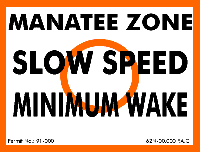
Manatee Protection Zones
What is a Manatee? Click here to learn more
Tides and Currents
- There is plenty of shallow water in the area. If you
take shortcuts away from marked channels it is easy to run aground which
can ruin your day.
- Be sure you pick up a local chart.
- Select the following link to review todays tide prediction: Tide Prediction
The Landscape Changes
Hurricanes can change the landscape. Channels that once were, may no longer be there or you may find uncharted channels. Buoys and channel markers may be destroyed or out of position. Be sure to review the Coast Guard Local Notice to Mariners which may include these changes. You still must be alert and have a designated look out when under way. Some changes may not be on the notice.
It's Busy!
In Southwest Florida, you may find greater boat traffic than you are used to. Are you familiar with the Navigation Rules? The area is governed by two sets of rules. Inland and International. Know your position and what to do when you are outside the lines of demarcation. Are you familiar with range markers and daymarks of the InterCoastal Waterway. If you're not, you should take a safe boating course. Test your NAVRULES knowledge.
Don't Drink and Drive!
Boating Under the influence of drugs or alcohol is not taken lightly in Southwest Florida. You should be prepared to be boarded by the U.S. Coast Guard, Lee County Sheriff's Office, Florida Fish and Wildlife Commission, Cape Coral Police or the Fort Myers Police who routinely patrols the area. Even a single beer may cloud your judgement. You may take risks that you usually wouldn't do. Be safe on the waterways -- leave the party for the dock or have a designated driver.
Security Zones
There are several security zones and regulated navigation areas. Click here for more information. Never approach any military vessel or cruise ship.
Lake Okeechobee Waterway
Always consult the Army Corps of engineers website for locking information. Click HERE for current navigation bulletins.
Report Damaged Buoys and Signs
Call the FWC's waterway marker hotline to report damaged waterway markers (signs and buoys) that may pose a hazard to navigation. Information to have when calling (1) Location of damaged marker (GPS coordinates, body of water name, nearby landmarks, nearest town, etc. (2)Brief description of the problem (3)Your name and contact information. CALL toll free: 1-866-405-BUOY (2869)
Links