
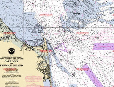
RNC Charts
Free online Charts are available for Down Load from the NOOA Site.
The ENC charts(Electronic Navigation Charts) are no longer free and are now available from vendors listed on the site.
The RNC charts(Raster Navigation Charts) are still available for download free of charge.
NOAA Raster Navigational Charts (NOAA RNC®) are full-color digital images of NOAA's entire suite of paper charts. NOAA provides weekly updates to the RNCs, which are available for free on this site in the BSB format. NOAA RNC® files are official data that can be used in many types of electronic charting systems, including Raster Chart Display Systems (RCDS) and Electronic Chart Display and Information Systems (ECDIS).
- RNC charts can be downloaded in several ways.
- use theinteractive world map on the site and browse to your chart- as you click on the areas highlighted in red to denote chart areas-you will see the menu on the right of your screen showing the chart designation of the area you have clicked on in the chart window.
- You will be given choices from the menu as to down load,(the RNC link)view, print, etc.
- click the RNC designation to download.
- You will be given choices from the menu as to down load,(the RNC link)view, print, etc.
- You can also click on the link at the top right of the Chart pages -"NOAA RNCs (RNC)" under the menu that says "General Information & Links"
- you will now be on a page with all the charts listed in various ways-by state, by number. etc.
- Typically you just click on a state and download all the charts for that state.
- Now you will need a Chart Viewer.
- "Open CPN" will load both RNC and ENC charts.(carefull not to download on any of the "Free" other software downloads.)
- use theinteractive world map on the site and browse to your chart- as you click on the areas highlighted in red to denote chart areas-you will see the menu on the right of your screen showing the chart designation of the area you have clicked on in the chart window.